
You could be forgiven for thinking that whilst visiting Peru’s most mountainous area of the Cordillera Blanca and the second highest mountain range in the world after the Himalayas, you’d feel somewhat small in stature, dwarfed in the knowledge you are surrounded by more than 20 enormous summits over 6,000 metres. Instead, upon arrival in South America’s number one hotspot for trekking and adventure sports, we felt our chests fill with fresh air, our backs straighten and our legs tingle as we got ready to come face-to-face with these giants.

At the heart of this mountainous area sits Huaraz. A pleasant and bustling modern town with a population of nearly 100,000, it’s the place to base yourself and arrange any number of heart pumping activities and adventures. Despite its size, we couldn’t help but feel close to nature here. On a clear day, the razor-sharp peaks encircling the city called out for attention and only a five-minute drive transported us to the countryside.
We stayed at Amelita Lodging in the centre of Huaraz, which deserves a special mention, because the young 20-something girl who owns and runs the place was one of the friendliest and most welcoming people we’d met in the whole of South America.

It’s not often you’re greeted on arrival with a huge hug and a kiss on the cheek and depart after nearly a week as good friends.
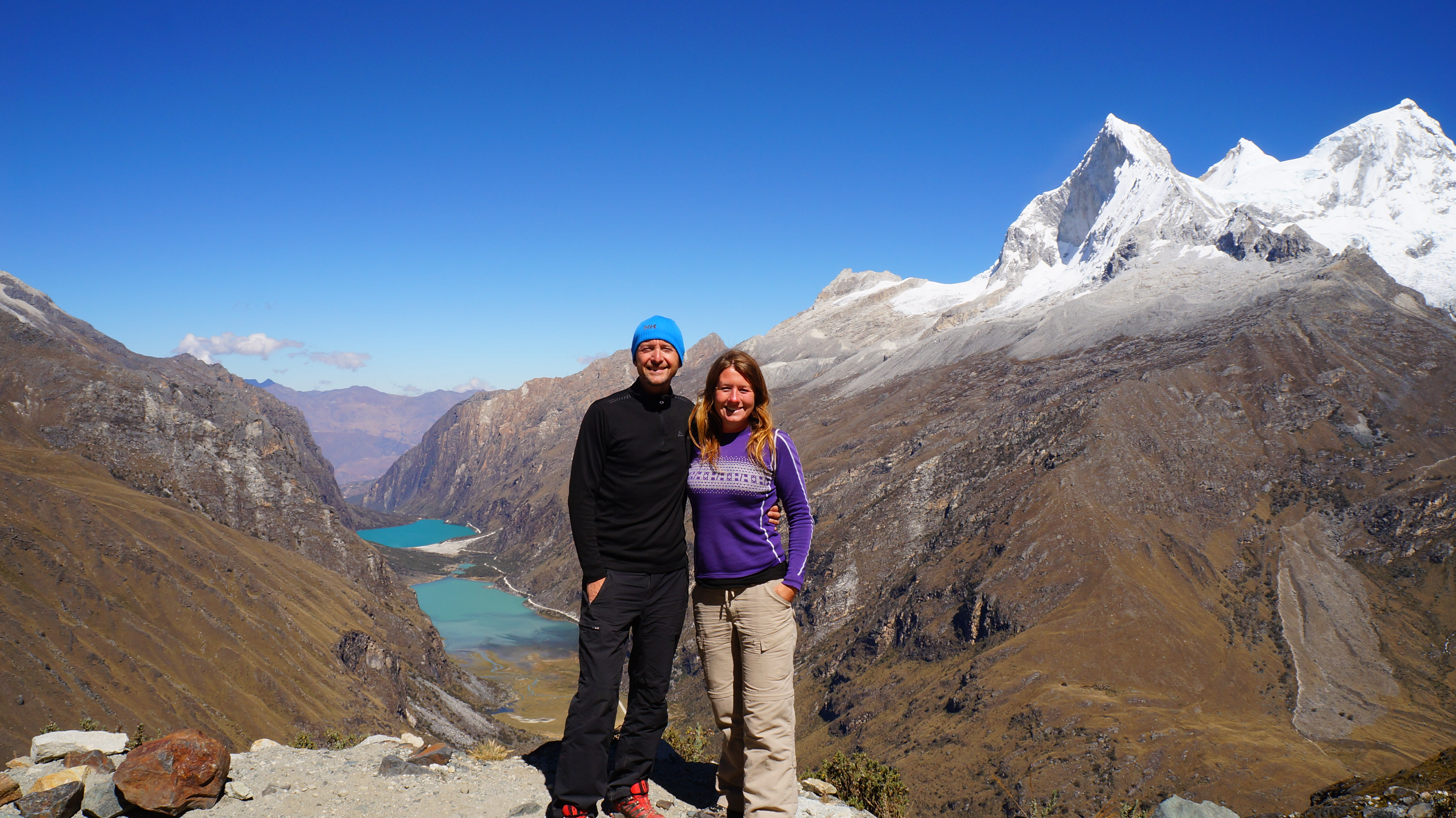
Possibly the most magnificent views in the Peruvian Andes can be found on the Santa Cruz trek in National Park Huascaran. The trek can be completed in 3 to 4 days with nights camping under the stars and cooking your own food. The trek covers 63 kilometres and at its peak reaches 4,750 metres at the Punta Union Pass. We’d completed several high altitude treks up to this point in South America and hadn’t experienced any serious side effects, however, since we’d been at sea level for the past week, we decided that a warm up would be sensible.
We chose a day hike out of Huaraz to beautiful high altitude lake Churup, which lies approximately 1,000 metres below the 5,495 metre peak of the same name. We took a short 30 minute combi (small shared transport vans) ride to the tiny village of Llupa, from where it was an hours walk to Pitec, the start of the trail. We could have waited for another ride along this final stretch of road but the sun was shining and the countryside was beautiful. Indigenous locals worked in the fields and ladies with their children walked goats and llamas to pasture.
We were touched by the genuine warm welcomes we received. Toothless, weatherbeaten old men sitting on walls outside their tumbledown stone houses offered us gummy greetings and ladies in pretty woven fabric dresses giggled to see us and waved.
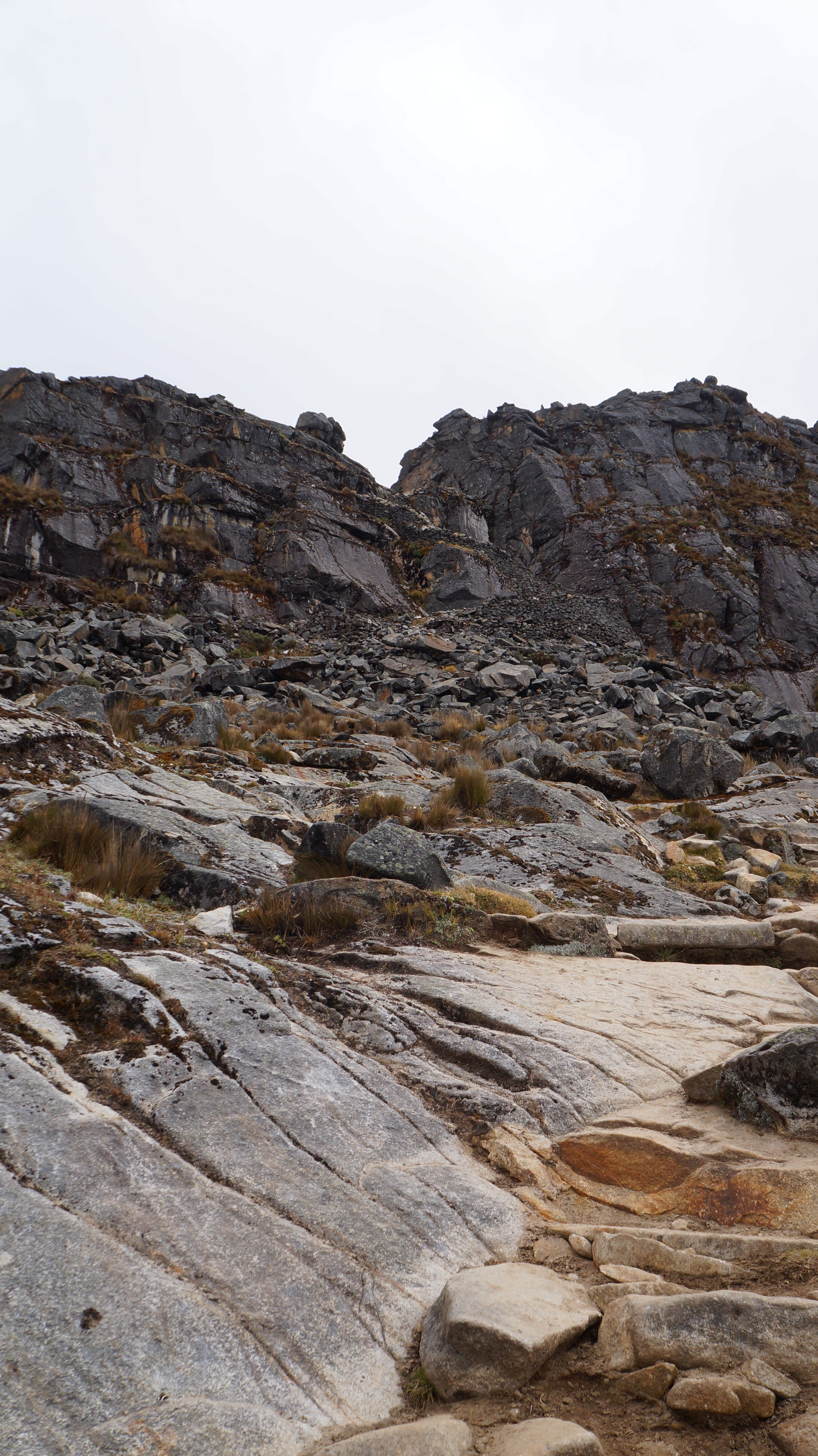
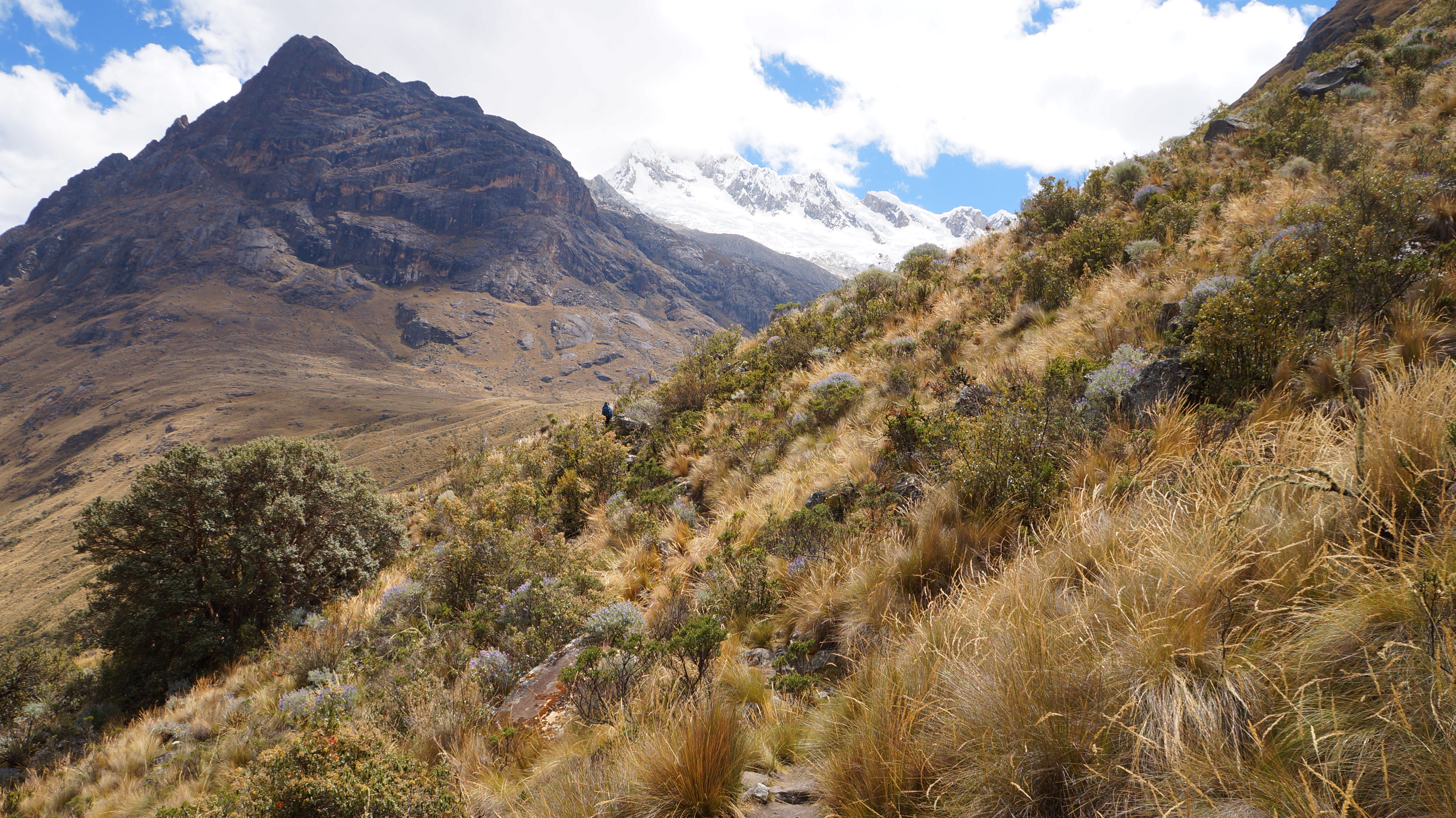
The path was easy to follow and the villagers were keen to point us in the right direction. In the valley below, Huaraz was nestled in-between the mountains and from where we were it looked like a toy town. We could see that the rolling grasslands and ice-cold emerald rivers which surrounded us, transformed at higher altitude into pale grey granite rocks and photogenic snow-capped peaks.
From the village of Pitec at 3,850 metres, it took us around 2 hours steady walking to reach Churup lagoon. The first section of the trail followed a rocky path up rolling hills with excellent views back down the valley. The final 40 minutes of the trail became steeper and more technical but this was still our favourite part of the trail. The path followed of a series of cascading waterfalls and climbed steeply up to the lagoon. In some sections ropes had been fixed to the rocks to help with hauling yourself up at tricky points.
Just when we thought that we must have taken the wrong path and there was no possible way a meer mortal on a day trek could scale that cliff face, we’d see another stretch of rope trailing upwards and out of sight!
Surprisingly, the 2 hour climb affected me more than any other on our South American trip. Out of the blue I really struggled with the altitude and I found myself gasping for breath and needing to take breaks every few steps. I frequently rested my head in my hands to stop myself feeling dizzy and when Dan, who was always ten steps ahead, called back ‘Are you OK?’ of course my answer was ‘I’m just fine!’ but really I felt like death. It was a strange feeling to be surrounded by a landscape we’d encountered many times before but feeling a shakiness in my legs and an unnerving pressure in my chest!
The effort to reach the top was worth every aching muscle when the view of Lake Churup came into sight. We were jubilant and hit the air with fisted hands.

We found a spot to sit and take in the views and catch our breath. We sat there for a long time but we weren’t interested in moving an inch from that spot. The sun drifted in and out of cloud and the deepest sections of the lake changed from greyish-blue to deep green.

Where algae had grown on the rocks at the water’s edge a rainbow of colours burst from below the surface. In the water we could also see beautiful reflections of the high rock walls surrounding the lake. A few other people had also made the climb that morning and they milled around – moving from one great view-point to another.
We sometimes caught people in our photographs, standing on the rocks in front of the Churup Glacier and they put into perspective the sheer size and scale of our surroundings.

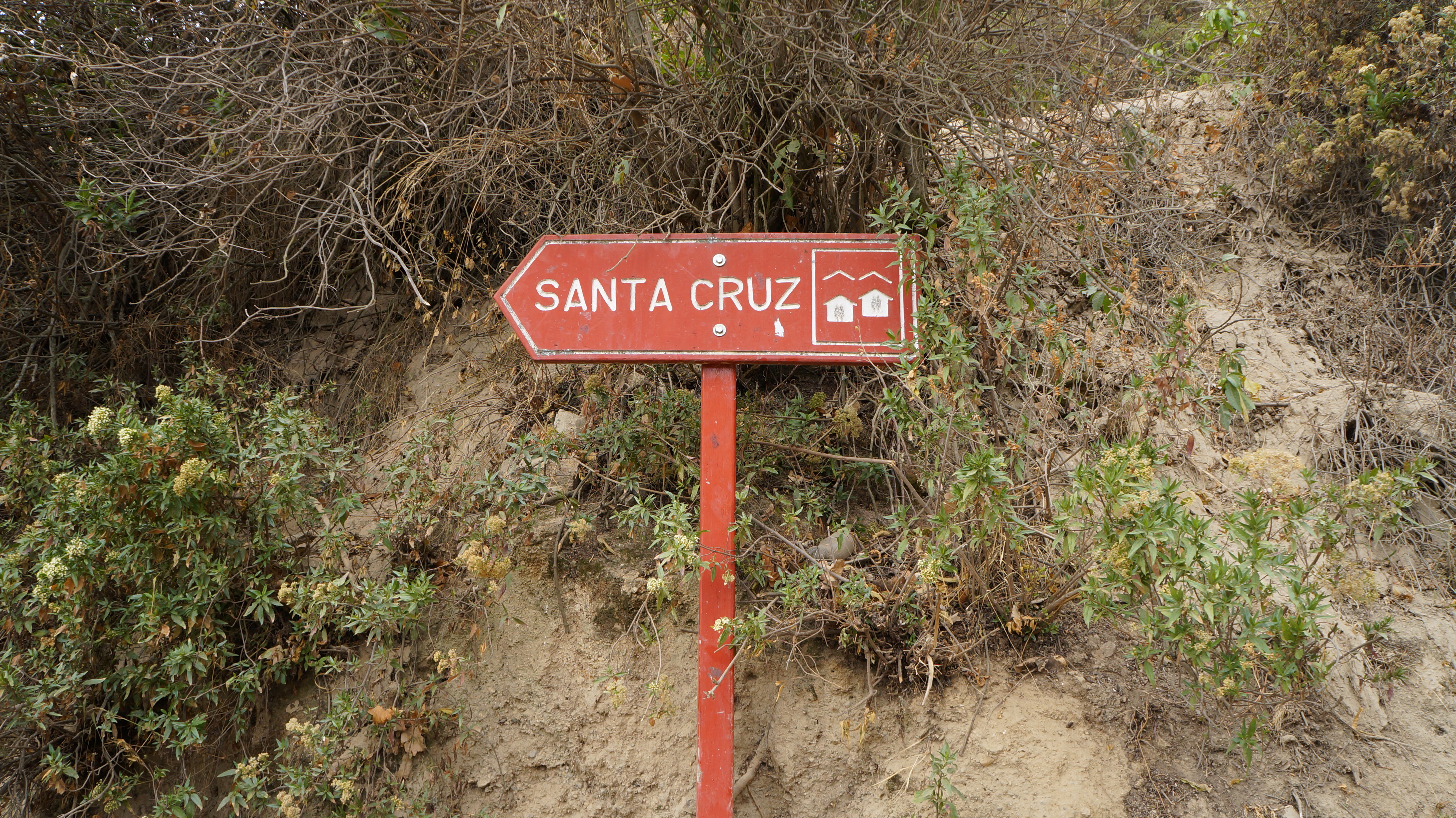
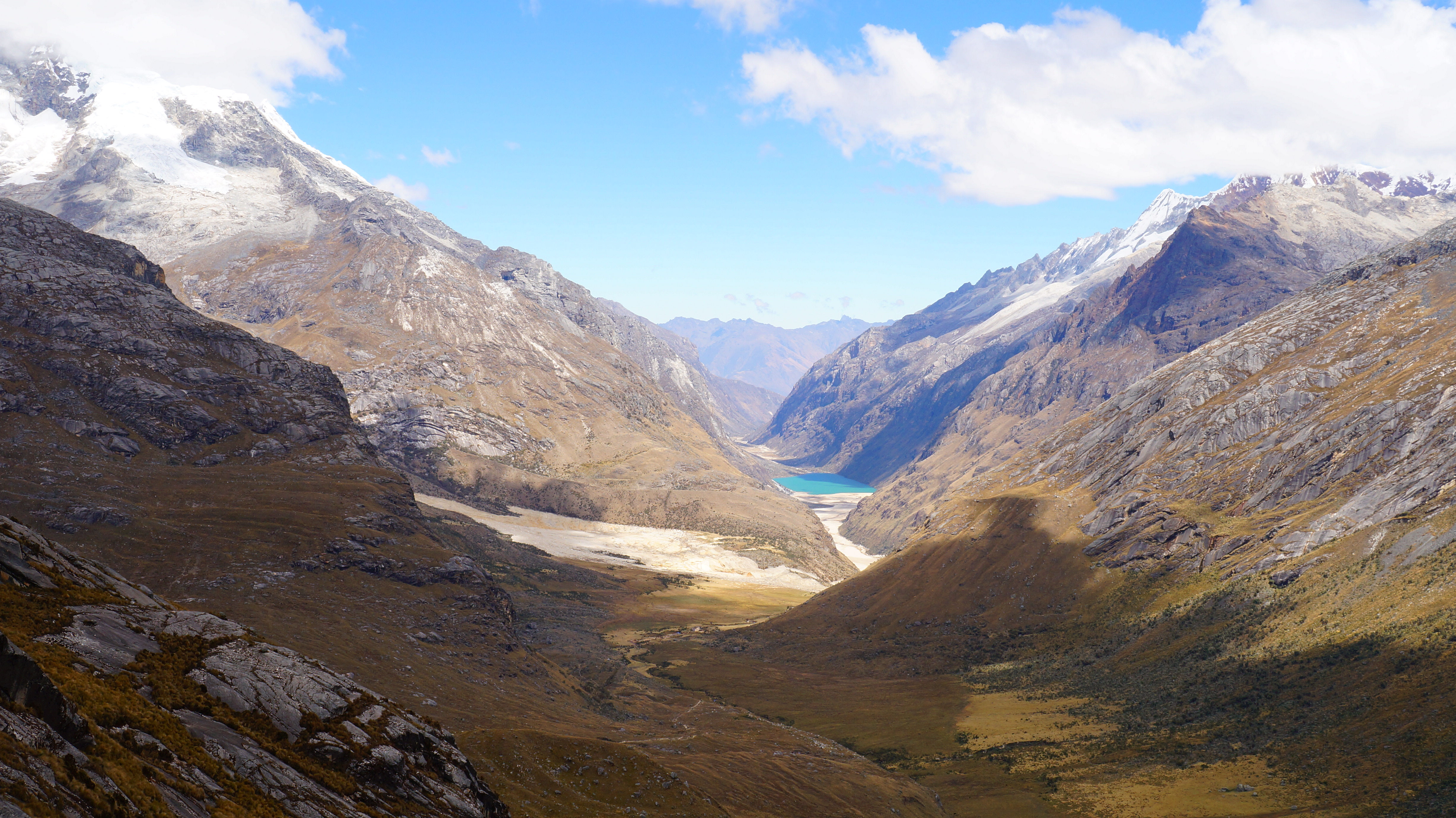
After this enjoyable warm up, we were ready for the Santa Cruz trek. We decided to trek independently, carrying our own tent, food, and cooking equipment and taking 3 full days to complete the trek. For ease we booked our transport to Vaqueria, a village where the trail begins, with an agency in Huaraz who were taking 5 others on the same route. We took this option to save time as the transport is infrequent in the area but also because we wanted to stop en-route (three hours from Huaraz) to visit the World Heritage Listed Lagunas Llanganuco which the tour offered but the local bus would not. It’s possible to walk the trail starting in either Vaqueria or Cashapampa and finishing in the opposite place but we’d heard that Vaqueria offered marginally better views whilst walking and that the initial climb up wasn’t as steep.

The National Park covers 3,000 square kilometres and offers endless options for the walking enthusiast from one day hikes to glacier filled lagoons, to challenging two-week jaunts. Those feeling particularly brave and strong can also strap on crampons and ropes and, with a professional climbing guide, attempt to summit one of the many peaks.
We were picked up at 6.00am and drove around one hour to Yungay where we turned towards the mountains and started to climb. Yungay was quite an unremarkable town in its appearance but its bland exterior hid a dark and haunting past. We were interested to hear that as recently as 1970, Yungay was the site of the biggest disaster the Andes has ever seen. As the town’s residents slept in their beds, an earthquake caused an enormous landslide shifting 15 million cubic metres of granite rock and ice down the mountain completely burying nearly all of the town’s 18,000 population. A memorial now sits a the site of the old town and the new town was relocated far from the face of the mountain so history would not repeat itself.
After paying our park entrance fee (65 Peruvian Nuevos Soles – approx 23 USD) our mini bus climbed to the edge of the lagoons and then onto a high vantage point where the views were incredible. The lagoons were bright turquoise in colour but rather than clear they looked milky and mineral rich.
The lakes were nestled at the base of a steep, narrow valley. Rising majestically above the valley some of the world’s most highest mountains burst into view covered in fresh layers of snow. From here we had a great view of mountain Hauscaran (6,768 metres), after which the park is named, and which is the highest mountain in the whole of Peru.

We posed for endless pictures until it started getting silly – how many images of this wonderful panorama could we possible squeeze into one album?
After behaving like a herd of frantic paparazzi for around 20 minutes, the mini bus driver was becoming impatient and a honk of his van horn signaled it was time to move on. We drove over a high pass and down the other side using an endless series of zig-zag roads and passing more mountain vistas with gorgeous bright pools of melted glacial water. And finally, we reached the tiny village of Vaqueria.
The tour group saddled up their waiting donkeys and enthusiastically set off with their guide. We watched closely so we could eventually follow their lead…but of course claim all the glory of self navigation.
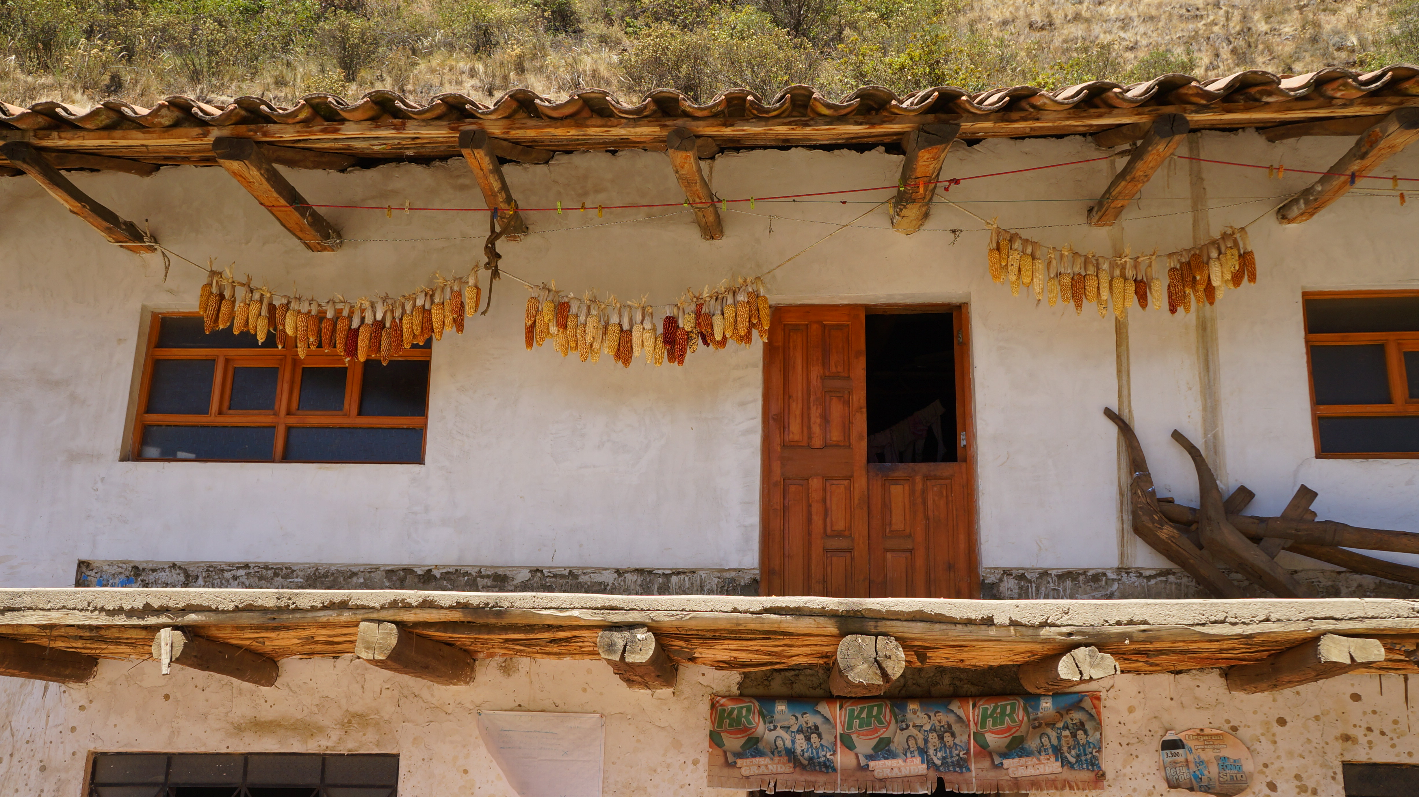
We gathered our backpacks and before departing we called into a small shop for a final indulgence of fizzy drinks and chocolates whilst sitting in the sun. The farm-house was a picture of rural bliss with white washed walls and corn on the cob drying on washing lines to be preserved and used later for soups and stews. The pair of us were like lizards trying to extract enough energy from the sun to see us through the day ahead.
The first day trekking took us around 4 hours and we climbed 600 metres on undulating paths from 3,440 metres to 4,000 metres. We could already feel that the altitude had got our hearts beating a little faster. We passed through several small mountain communities in the first hour of our walk, who relied on farming for survival.

Where the trail passed in front of farm houses some locals had seized the opportunity to open their doors to tourists interested in learning how to milk a cow or how guinea pigs breed, in exchange for some small change which seemed like a positive way to help the community.

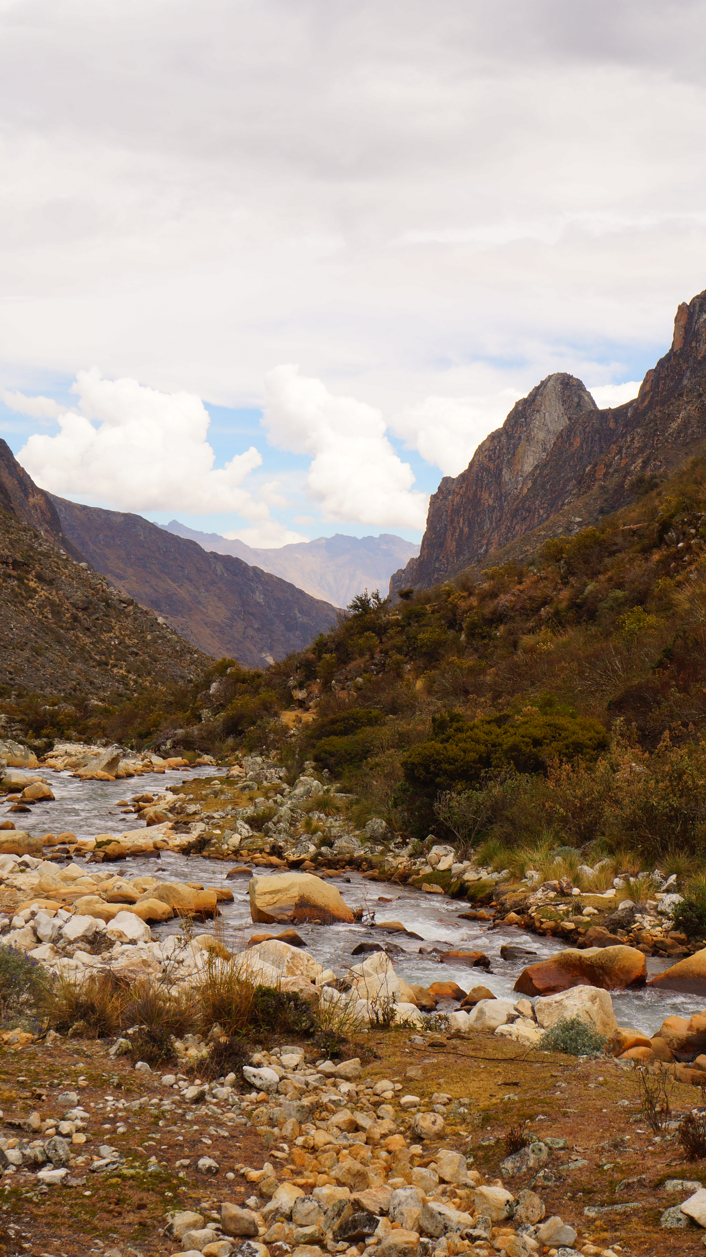
Further into the mountains, the rolling hills and farmland was replaced with rugged terrain.

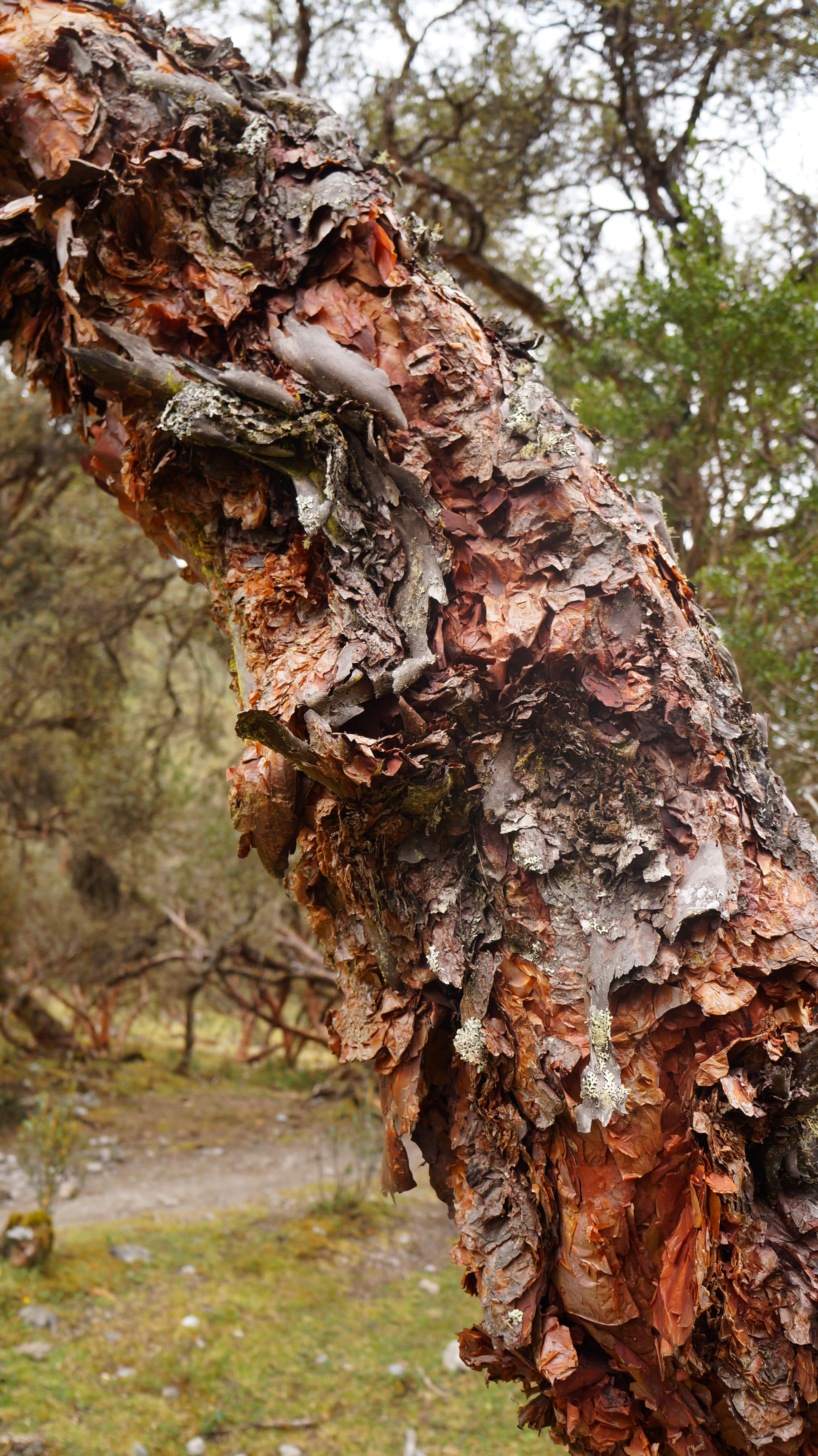
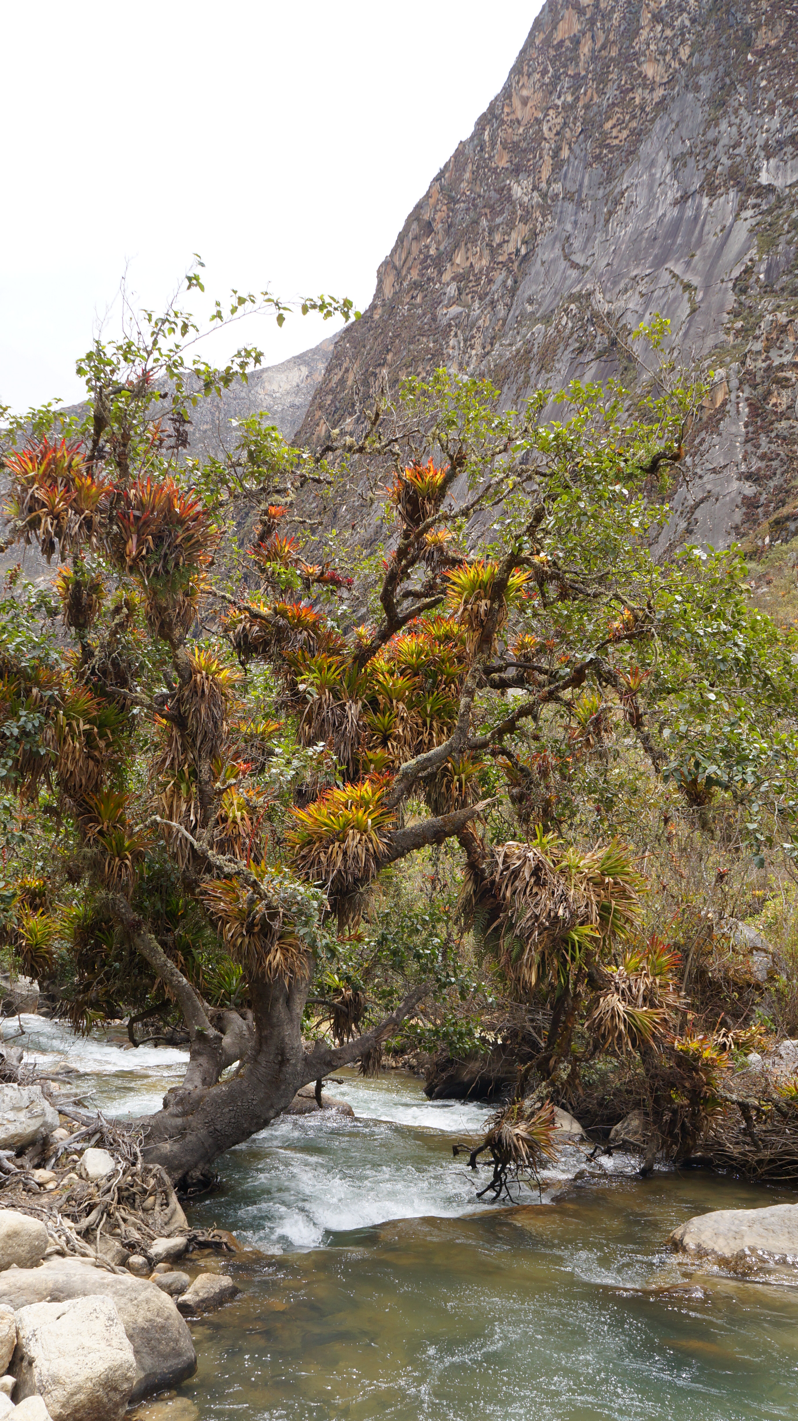
We walked through beautiful woodlands filled with hundreds of reddy-brown trees where bark peeled away like layers of tissue paper from the tree trunks and hung in artistic formations.

In places, trickling streams carved their own paths through the landscape, changing course when they met with an obstacle, or creating small pools where the ground dipped into a basin. The ground was quite boggy in this area and we hopped around to avoid our shoes becoming sodden but, as is often the case, when avoiding one puddle, we inevitably found another which was bigger and deeper.
Wild flowers enjoying the strong Andean sun dotted the sides of the paths and added splashes of colour to the predominately green blanket of grasslands.

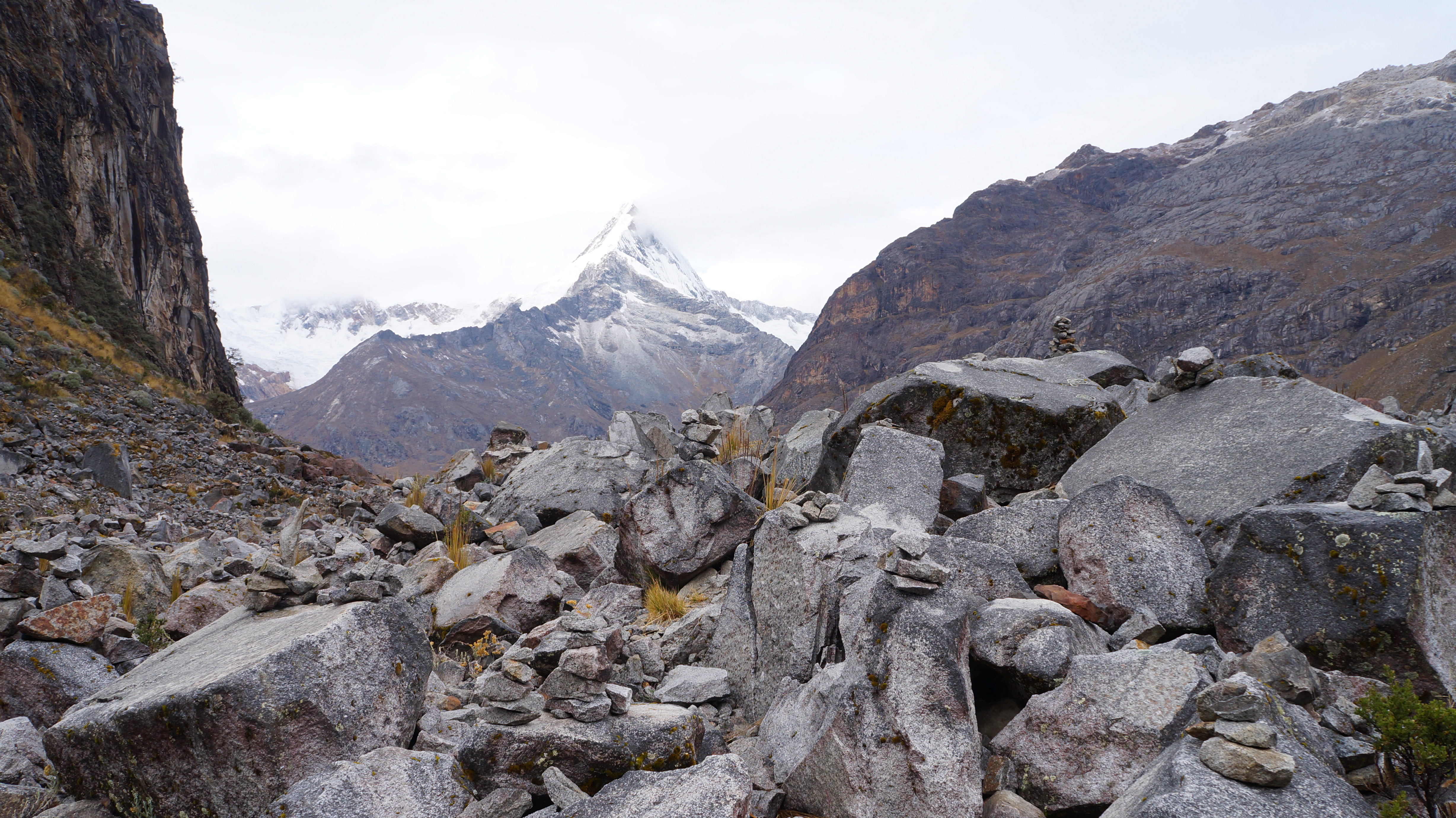
The mountains teased us initially – hiding behind clouds or only poking the very tip of their pyramid-shaped summits above the valley walls. However, we didn’t need to wait for long before we were up close and personal with them and could hear them cracking as small avalanches fell over a section of the face.

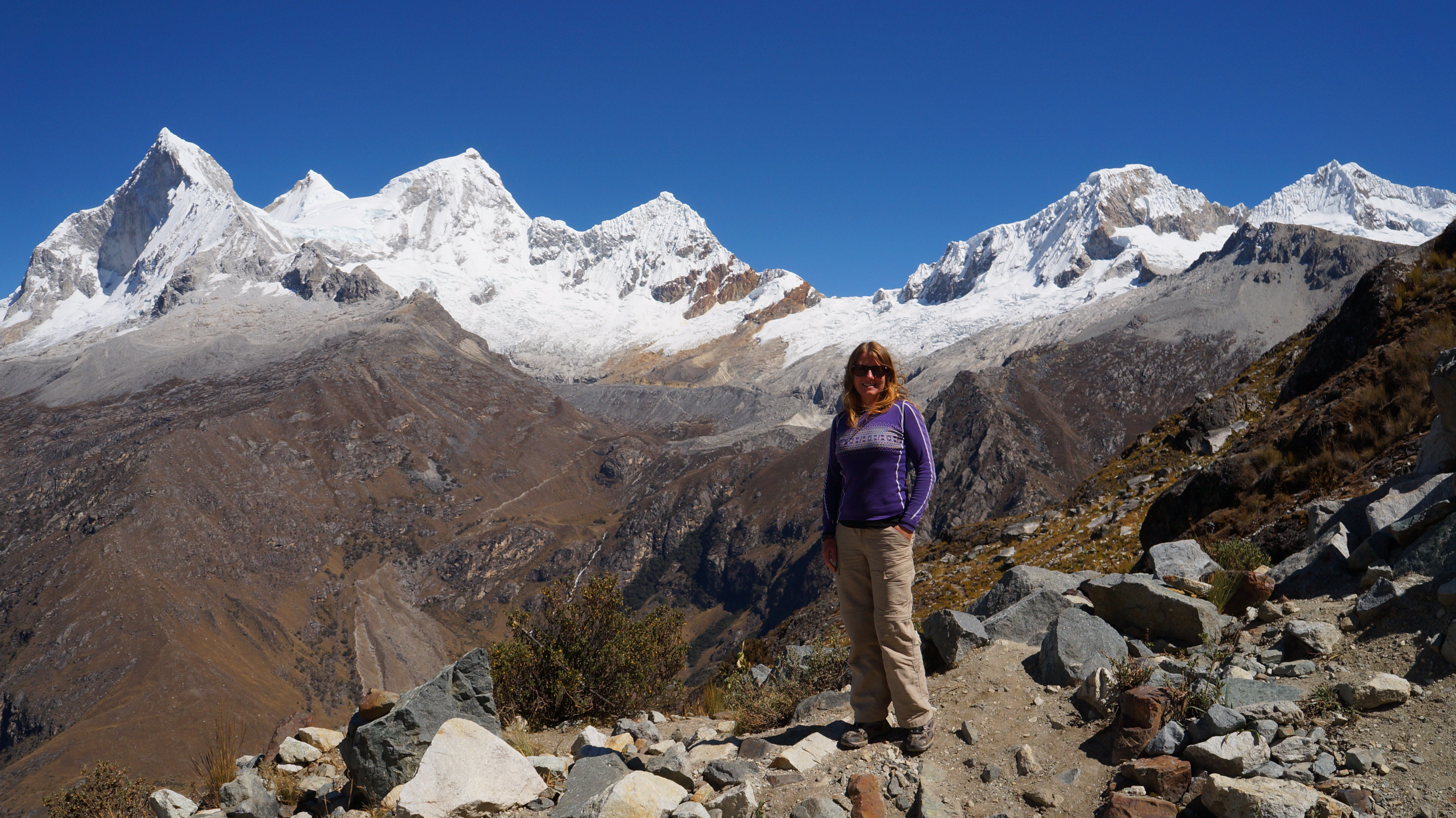
The second day of trekking was the most challenging and we needed to dig deep in our fitness reserves to make it over Punta Union pass which, at 4,750 metres above sea level, is the highest Dan and I have ever climbed (just 60 metres short of the summit of the tallest mountain in Europe – Mont Blanc 4,810 metres).
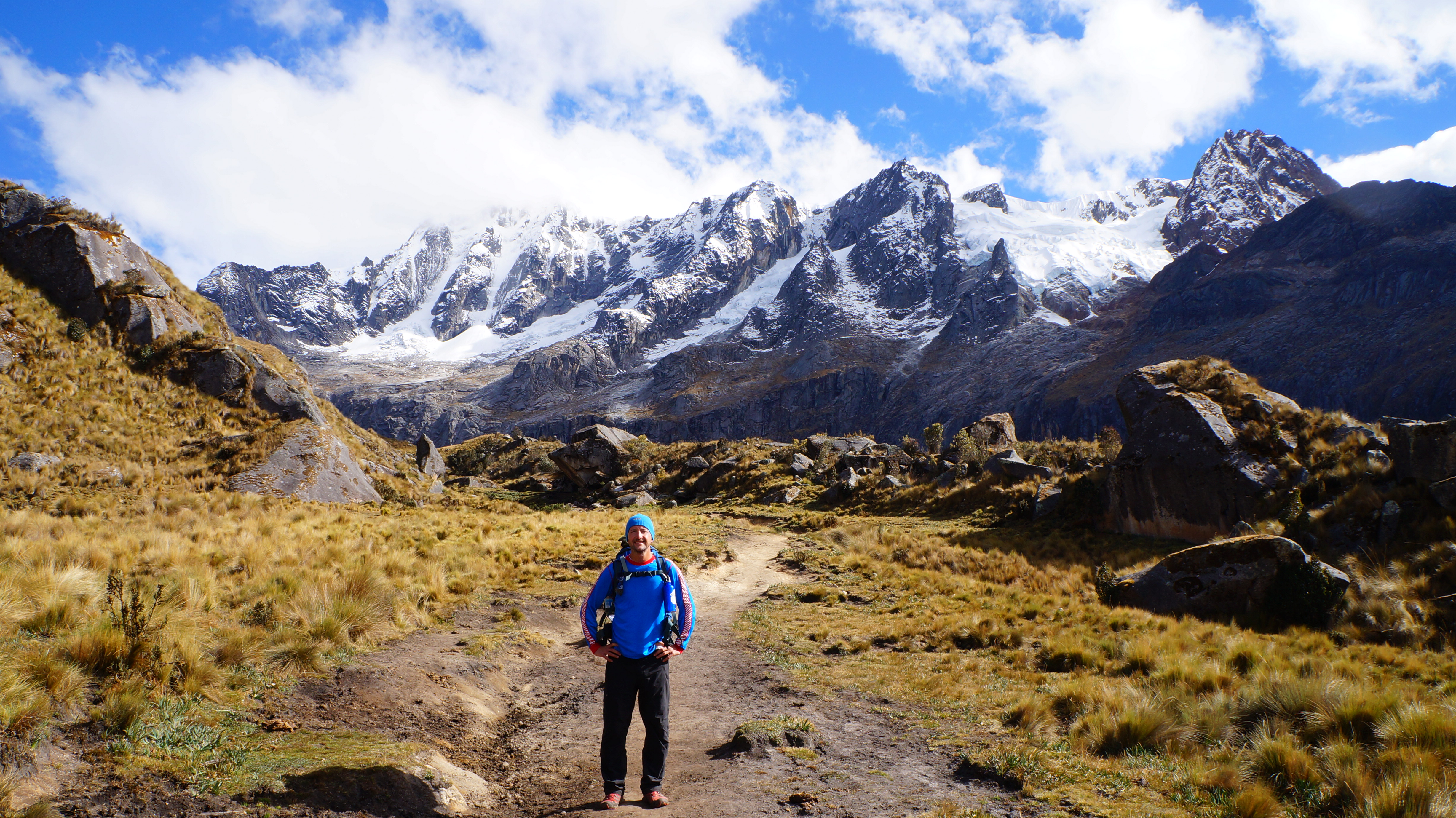
From our camp it took nearly three hours to reach the pass, the first two hours a steady uphill climb and the last hour a steep scramble up scree paths and flat sided chunks of granite rock. The views continued to amaze us. Brown and green coloured moss covered grey rocks, yellow Andean grass swayed in the breeze and white-tipped mountains were accentuated against blue skies. If an artist had painted this picture, they would have been accused of creating a fantasy world…but here we were walking through it.

With our backpacks bulging full of equipment our hearts felt like they may explode and our legs would not obey our brains, needing to stop every few paces. The best distraction was to empty our brains of everything and simply admire the epic scenery. We had front row seats to nature’s spectacular performance.

The other thing which got us through the climb was sheer bloody determination not to be beaten to the pass by a donkey herder. The little old man, who could have been approaching 70, had been following behind us with four donkeys for some time. With the strength of an ox, he never faltered or paused to take a breath, he just kept steadily walking on and gaining ground on us. We daydreamed of sports page headlines where the old man and his donkeys hoisted aloft their climbing gold medal whilst paramedics tried to revive me and we just kept walking.

We reached the pass at least 5 minutes in front of the donkey convoy and we were jubilant. A sign post marked the highest point and this was our gold medal.
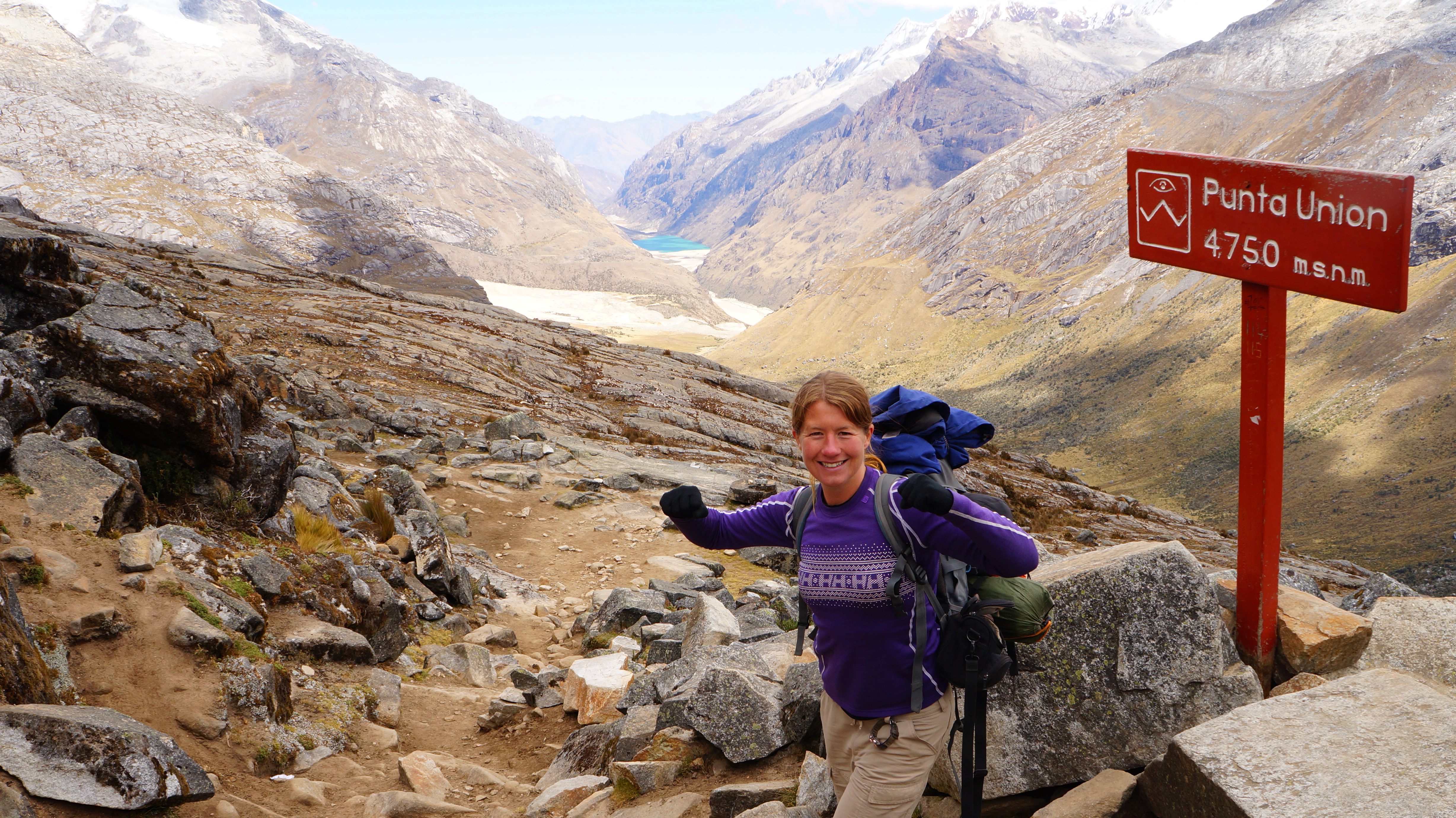
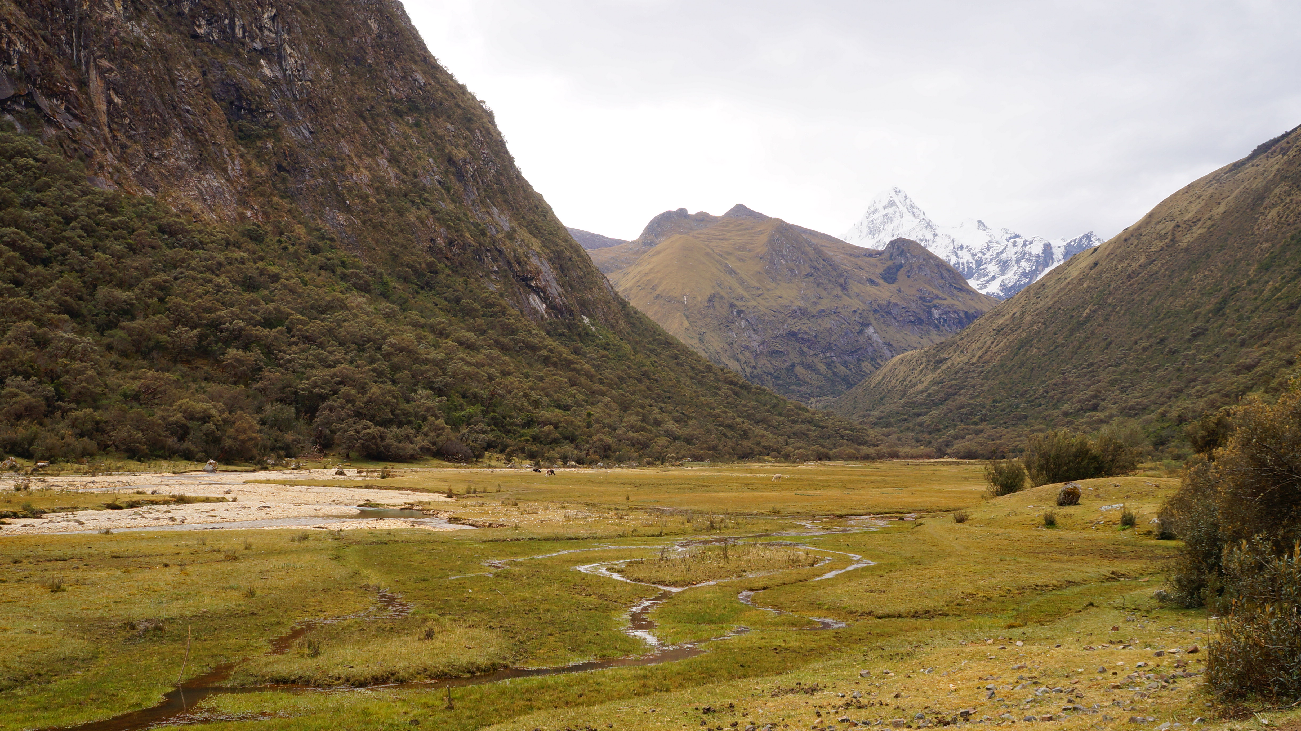
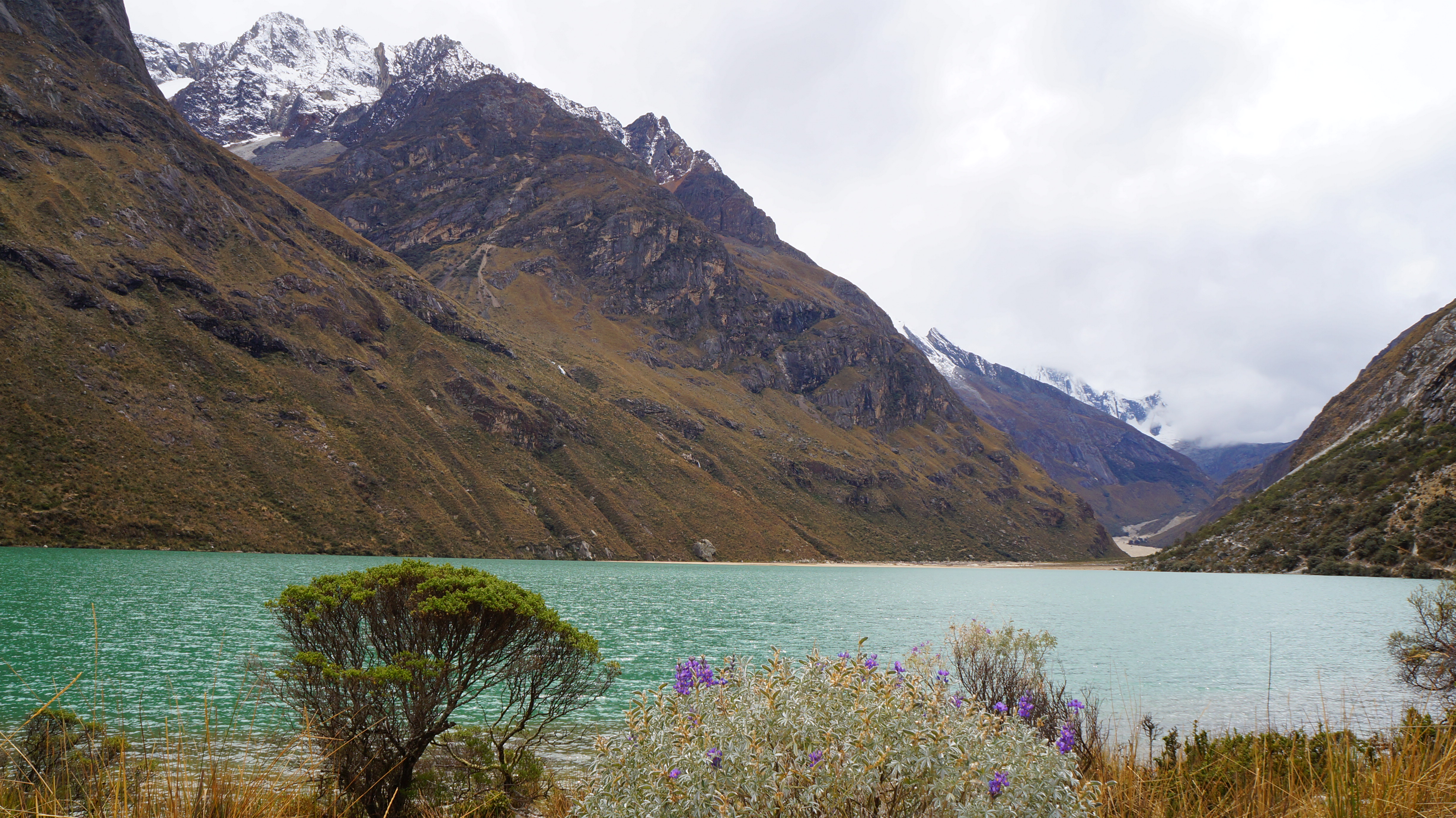
The wind hustled through the pass and threatened to knock us off our feet but we stood fast admiring the view. From here we could see that the valley from which we’d just walked had a golden hue and was sprinkled with small grey lakes.

We were now at eye level with a monstrous beast of a mountain.

We could see up close deep crevasses, the pale blue tinge of glacial ice and frozen waterfalls. We got a sense of just how immense the Cordillera is, admiring its spine stretching out in both directions.
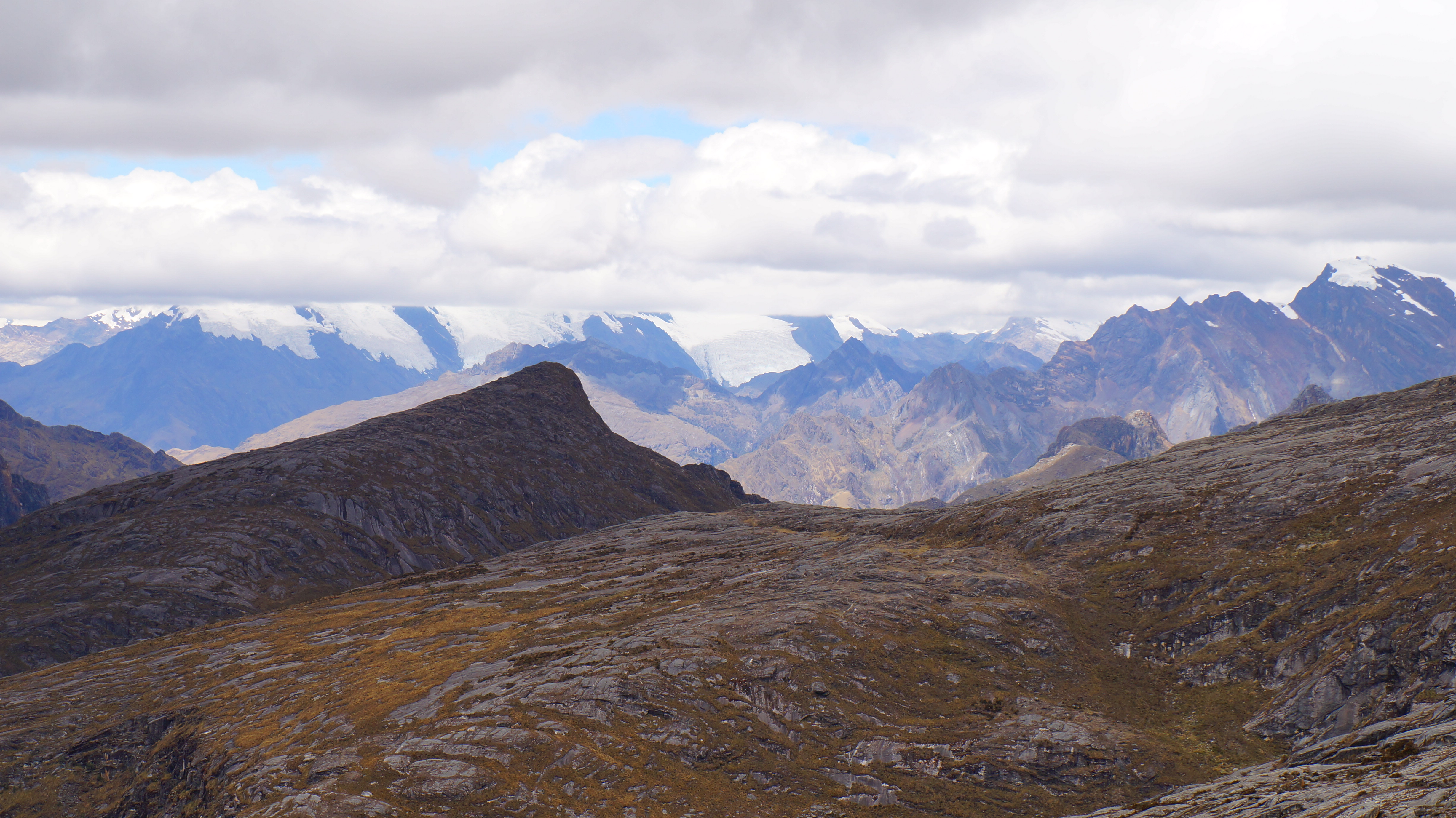
The view from the other side was equally impressive and we were very relieved that, for the next few hours at least, it would all be downhill.
On the way down we encountered a British and Dutch partnership making the reverse trek to us and we offered them words of encouragement remembering how we’d felt on the other side and hearing their panting. Knowing that both nationalities are fond of a few drinks, we assured them that the bar at the pass was selling ice-cold beers and showing international football on large screens…and they left with a spring in their step.


We could have camped for the night near to the base of the pass, however, we’d arrived there by 1.00pm and decided to push on after a short rest for lunch.
The final stage of the day was very draining but really worth it as the skies were clear (unlike the following morning) and the vistas continued to impress us. It was easy for us to forget the brutal power and savagery of nature when the weather was warm and everything was peaceful. Across the valley from the path we took, we could see that half of the mountainside had been torn away where flood waters had obliterated everything in its path.
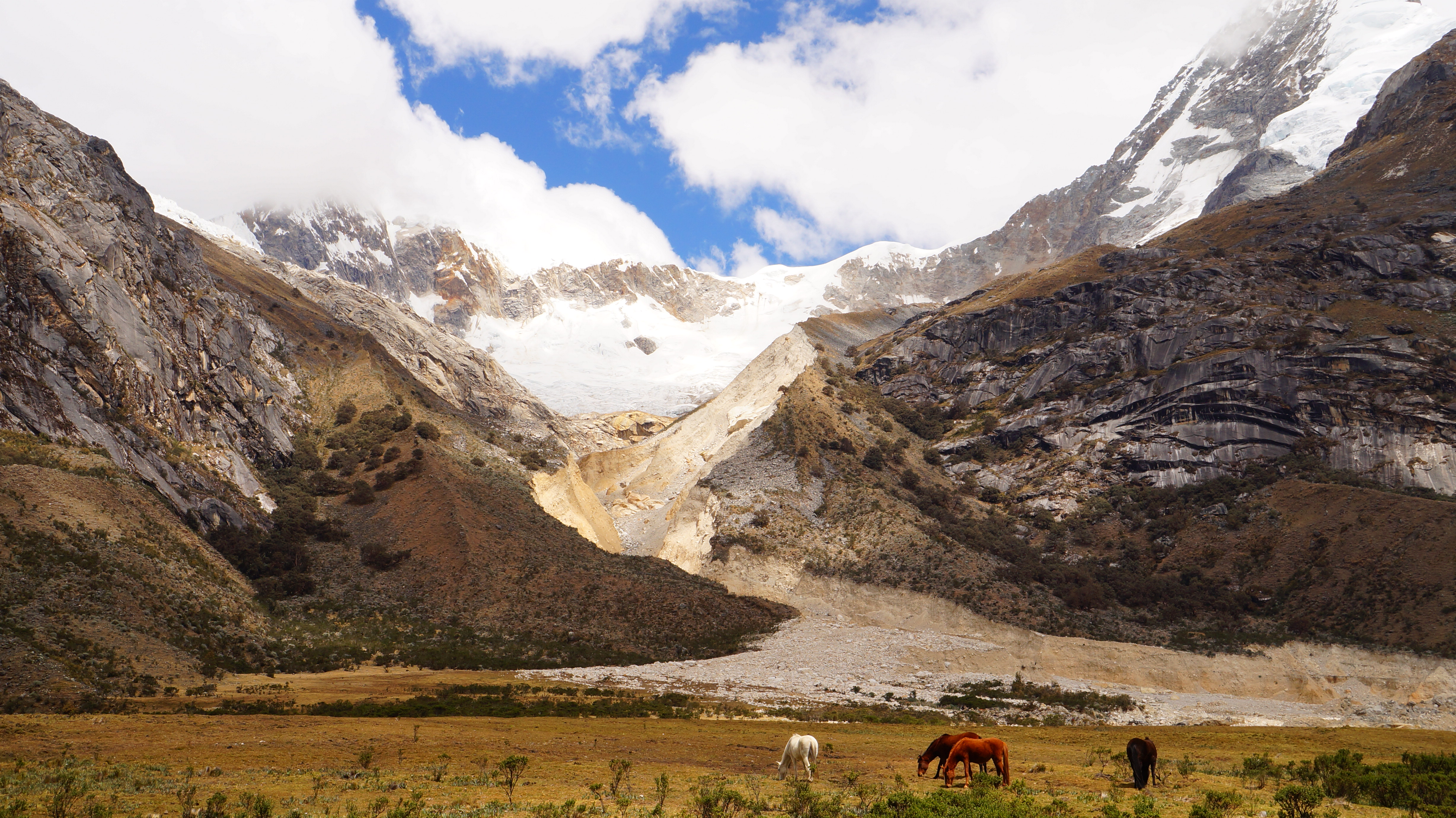
It took us around two hours to reach the area in which we’d camp for the evening and by this stage we’d slowed to a purposeful shuffle. A number of cows grazed on the fertile land and Andean hawks and eagles sawed above us.

Before we realised it, we’d entered a bowl and we were encircled by mountains. We craned our necks this way and that taking everything in.

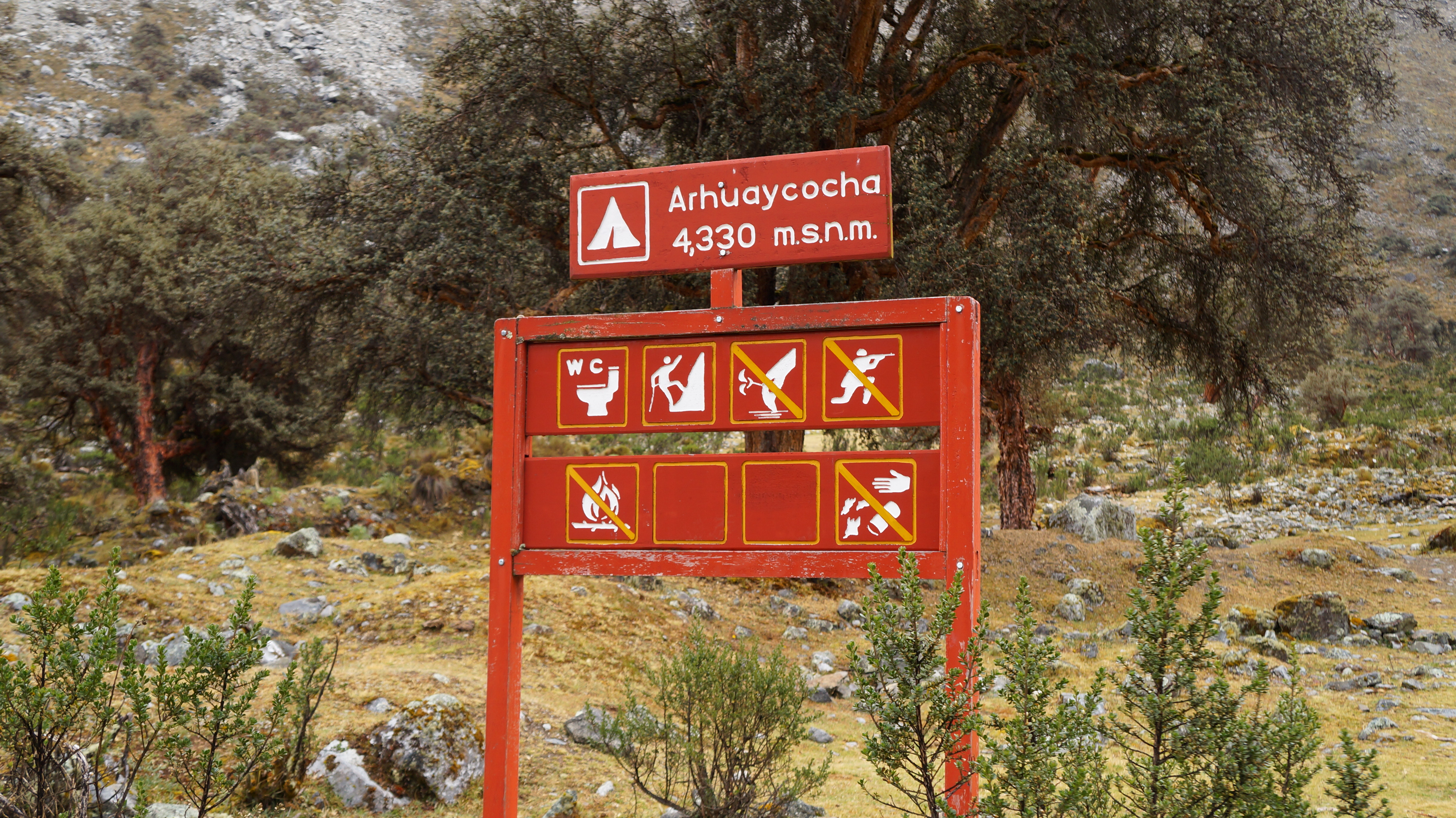
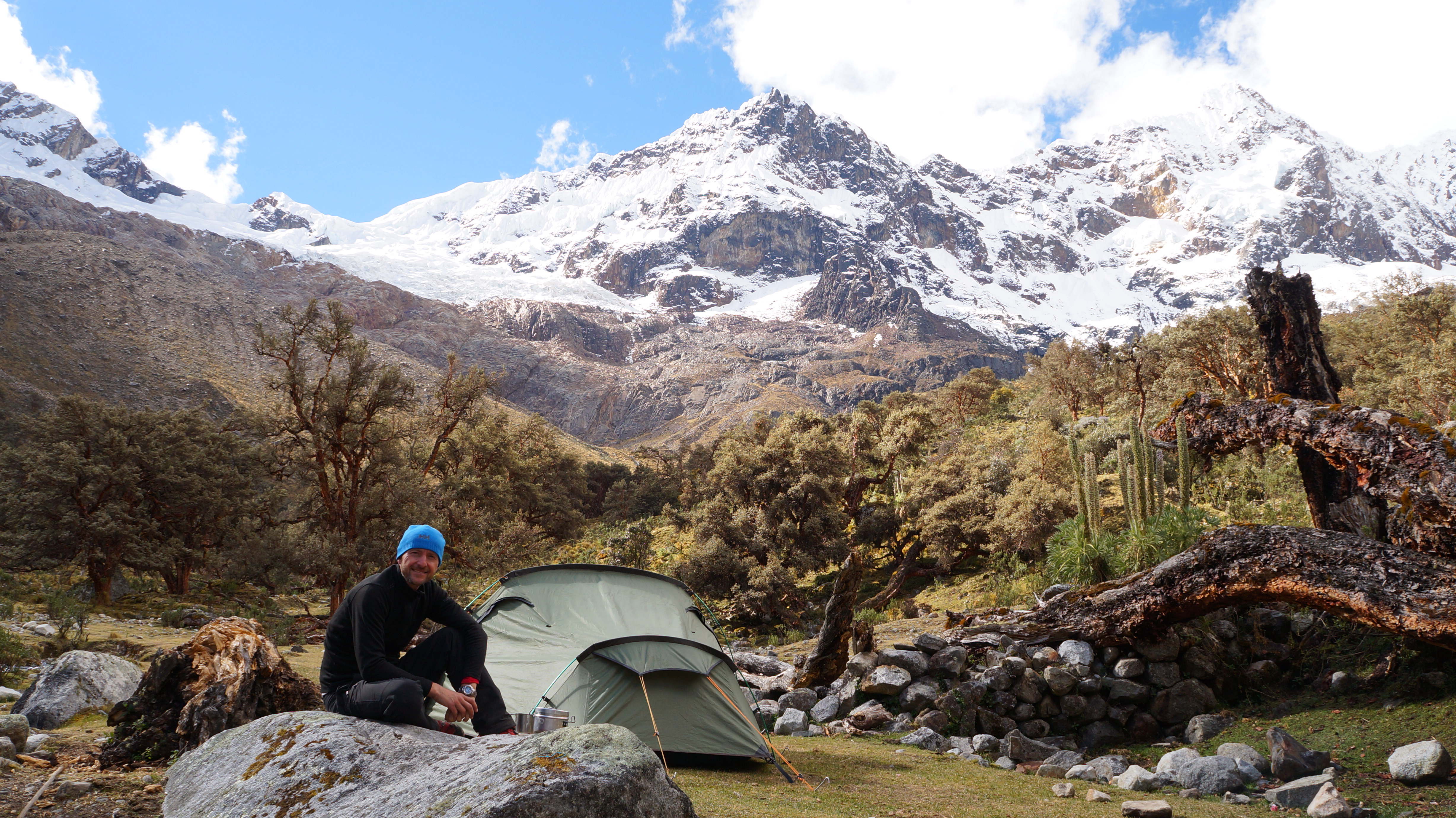
There are no mountain shelters on the Santa Cruz trek so camping is the only option. There are designated sites along the route where it’s permitted to camp but there are no cooking, washing or toilet facilities so it’s morning baths in freezing streams which take your breath away, and cooking with bottled gas and camp stoves!
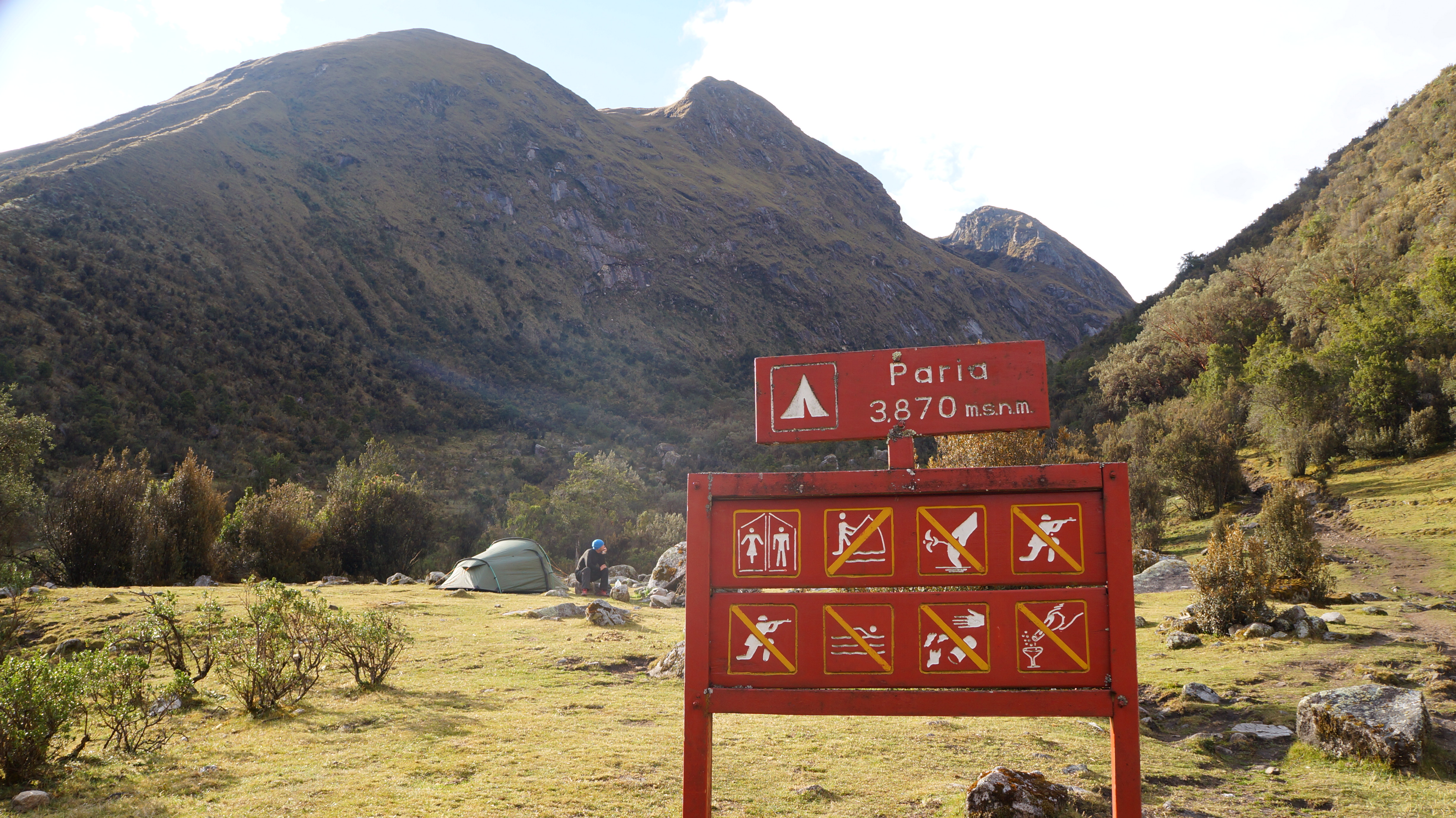
We spent our first night at Paria camp and our second night at Arhuaycocha camp and both offered flat, grassy areas next to bubbling brooks and scenery which killed any chance of conversation.
Controlled fires are allowed in certain areas of the park so once we’d set up our tent, we got to work on collecting firewood and creating our focal point and heat source for the evening.

Walking strong and starting early each day, we made sure we reached camp by around 4.00pm so the sun was still high and we had time to leisurely set up and relax before the evening. We often found that when it was dark by 6.30pm when camping, we were ready for bed by 9.00pm so the extra couple of hours gave us the chance to really appreciate our surroundings.
We were joined at the first campsite by the organised group we’d travelled with that morning and a group of three other independent trekkers. We had to smile at the huge bedouin style tent, with dining and sleeping quarters, the porters erected for the tour group – they could have played basketball in that canvas shelter! On the second evening we camped solo and we felt very spoiled to have such untouched beauty all to ourselves.

The sunsets were simply magical – warm colours shot across the sky and framed the mountain silhouette perfectly.

We felt like whooping and hollering to hear our voices reverberating across glaciers and through ice caves but we were struck dumb with its awesomeness and sat peacefully taking it all in.
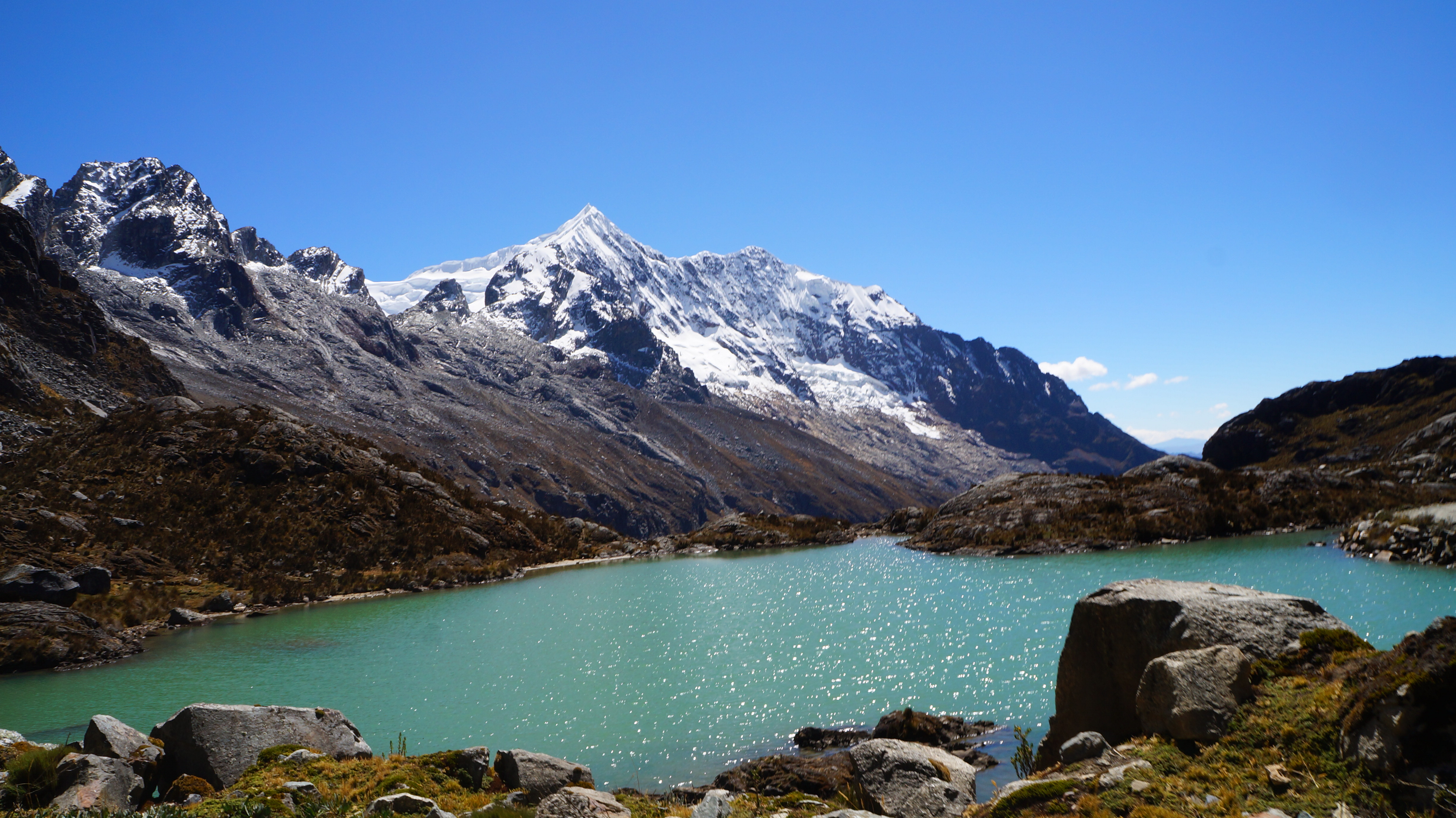
We awoke on the third day to low-lying clouds obscuring most of the views we’d enjoyed the afternoon before. The high-definition scenes were now a little grey and fuzzy around the edges but we enjoyed how the whole area felt like a different place. After breakfast we made a 30 minute climb to Arhuaycocha lagoon which is tucked under the towering summit of Jancarurish.
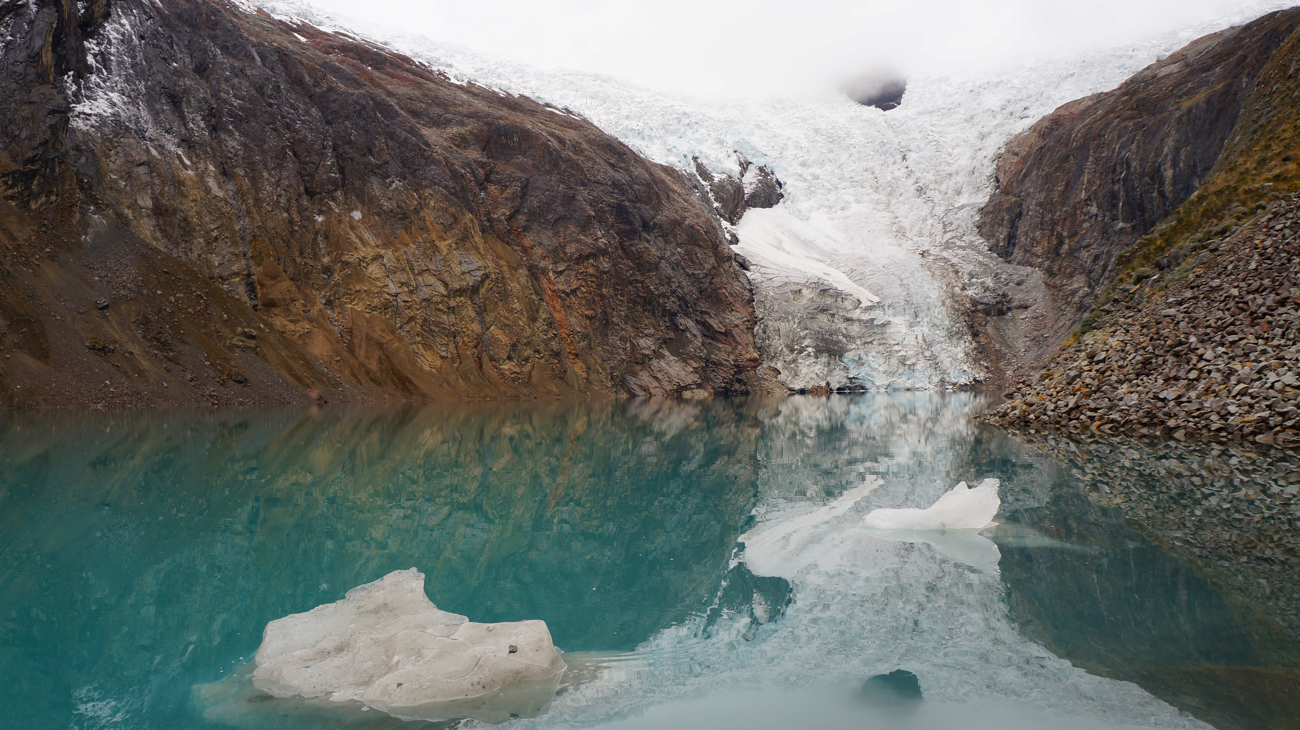
At one end of the lagoon a huge glacier spilled down into the water and chunks of ice broke off and sailed silently across to the shore. The whole area had a very spiritual feeling about it. All around us were piles of rocks stacked on top of each other in size order like mini shrines which had been created by other trekkers who’d been delighted to reach this point and wanted to leave a small marker as a testament.
The clouds which hung to the peaks made it feel like we’d stepped into a bubble with its own little world inside. We felt connected to the mountain we stood upon as we heard deep rumbles of shifting ice from deep within its belly.

We stayed at the lagoon for around half an hour and headed down the same way to pack up our things. As we retraced our steps through the valley a light drizzle fell. Water droplets hung from the trees and where we trod on the damp grass the imprint of our footstep remained. The rain didn’t last for long and at the point we’d made our diversion, we rejoined the main trail. We walked down through the riverbed which had been created by the floodwaters from the mountainside and towards a blue lagoon in the distance.

The ground was sandy and proved difficult to walk through with our heavy packs. We passed debris that had been washed down the mountain, such as uprooted trees and giant rocks. After walking for what seemed like a long time without the lagoon getting any closer but in reality was around an hour…we arrived at its shore.

Yet again the lagoon was a brilliant jade colour and it was surrounded by shrubs with bright purple and pink flowers. We caught glimpses of the mountains but their full glory was hidden. From this point, our backs were turned to these giants and it was all down hill to exit the park but there were a few surprises left to keep us entertained as we followed the course of a fast flowing river which bubbled and gurgled.
Waterfalls punctuated the craggy, moss-covered cliffs and we imagined, that like us, they too had been on an incredible journey from a snowy summit to reach this point.

As the village of Cashapampa came into sight, we knew that the Santa Cruz trail was nearly complete for us. Our energy tank was running on empty but our minds were full to bursting with images and memories of this breathtaking wilderness. In a world where it’s becoming increasingly difficult to escape from the trappings of modern-day life, it felt refreshing to put down our laptops and turn off our mobile phones, to escape social convention and responsibilities and to turn our backs on pollution and traffic jams, albeit only for a few days. We had reminded ourselves how to appreciate the simple things in life by going back to basics and living and breathing alongside nature.


Leave a comment